PUBLIC OPEN HOUSE OUTREACH
First Survey launched: Feb 17, 2020
About
Introducing Arcadis-Engage, an internal survey platform built for urban planning and land development employees of Arcadis in Calgary and Edmonton, AB. This online platform simplifies the process of developing custom surveys for public outreach initiatives. Arcadis-Engage offers a straightforward user interface that allows users to incorporate standard form features such as radio buttons, multiple-choice questions, and open text fields. Notably, the platform integrates with Google Maps, providing the ability to add pins to maps for spatial context within the survey.
Features
- Design your outreach as a single page or multiple pages.
- QR Code
- Google maps
- Results downloadable as csv
Workflow
- Create your content in Word.
- Provide images and maps and pdf documents.
- If there is a download section, provide pdfs.
- If you would like a project email address, this will be projectname@arcadis-engage.com
- Nominate a project manager who will receive emails forwarded from this address.
- If you would like a Google map, in the form or on the page, identify the centre point and zoom level
- Designate a start and end date for your feedback form.
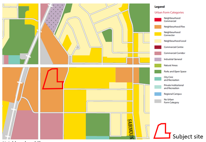
Sample Proposed Land Use
